The “Indian Ditch” Isn’t a Ditch: Gulf Shores Has an Ancient Canoe Canal from Around A.D. 600
But Gulf Shores has a deeper layer that most people never hear about—unless they stumble into the right local conversation.
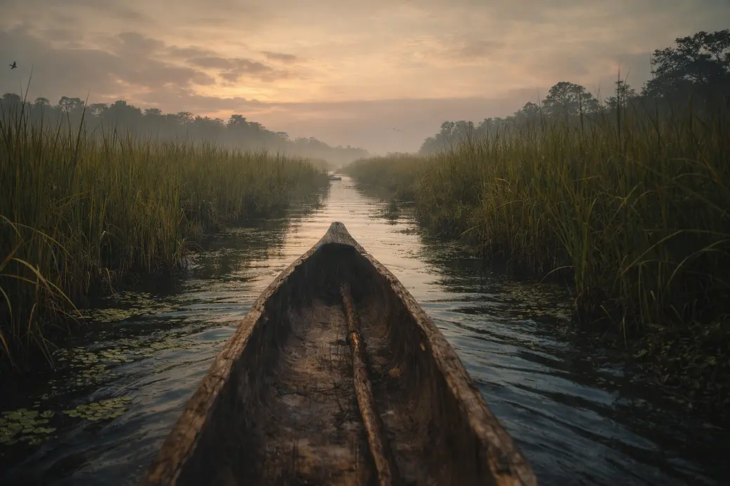
There’s an ancient canoe canal on the Fort Morgan peninsula that researchers dated to around A.D. 600. Not 1600. Not “old for Alabama.” Six hundred.
And it’s not some tiny trench, either. The original canal is estimated to have been nearly 1.5 kilometers (about a mile) long, running between Oyster Bay (north) and Little Lagoon (south).
The quick version: it was a handmade shortcut
If you were traveling by dugout canoe, this canal let you cut across the peninsula instead of paddling the long way around it.
Researchers believe it helped people move between inland waters and coastal fishing areas while avoiding a much longer route that required going around the Fort Morgan peninsula.
Translation: the Gulf Coast has always been a place where water routes matter, and people here have been solving “how do we get from A to B?” creatively for a very long time.
Why locals called it the “Indian Ditch” (and why that name sells it short)
For years, people casually called it the “Indian Ditch.” You may still hear that. The problem is the nickname makes it sound like a random trench instead of what it actually was: a serious engineering project.
One reason archaeologists were slow to take it seriously is that coastal Alabama has plenty of ditches from other time periods—logging, drainage, all kinds of stuff. Even the archaeologist who eventually studied it originally assumed it might be something much more recent.
The part I love: this got “discovered” because a local wouldn’t let it go
A Gulf Shores resident named Harry King kept pushing researchers to look at the site. Eventually, University of South Alabama archaeologist Gregory Waselkov visited in 2017—and once he saw it in person, he knew it was something different.
They dug test trenches, found charcoal, and radiocarbon dating came back at around A.D. 600.
So yes: a huge piece of Gulf Shores history got properly recognized because a local basically said, “Nope, you’re coming to look at this.”
How big was it, really?
Different reporting summarizes the measurements a little differently, but the consistent takeaway is: not small.
One account describes the trench around 30 feet wide and 3 feet deep.
Another describes a flat-bottomed canal roughly three feet deep and about 20 feet wide inside sand berms.
Either way, that’s a lot of digging with hand tools—plus clearing a path through coastal forest—on a hurricane-prone coastline.
The “wait… how did it even work?” question
Here’s where it gets extra interesting: the canal crossed the crest of the peninsula, which means it wasn’t just a simple “dig at sea level and let water fill in” situation.
Researchers have suggested a few things that may have made it usable, including:
-
seasonal high groundwater/water table (more water in winter)
-
possible earthen dams at the ends to help hold water levels
In normal-human terms: whoever built it understood the landscape and water behavior way better than “let’s just dig a trench and hope.”
What it tells you about life on the Gulf Coast back then
Garden & Gun describes evidence the canal was likely used seasonally for transportation and trade, and that it helped connect coastal resources to bigger inland networks.
They also found signs of people processing seafood near the canal—fish bones and shellfish remains that suggest campsites where catches were handled before heading back inland.
So this wasn’t a novelty project. It was infrastructure—built for food, movement, and connection.
The surprising social detail: big project, not necessarily a “chief ordered it” society
One of the cooler points the Garden & Gun article highlights is that Indigenous societies in this area around that time are often described as more egalitarian, without the kind of rigid hierarchy people assume is required for massive coordinated labor.
So the canal also tells a story about community coordination—people organizing big work without the usual stereotype of “one person at the top making everybody do it.”
Can you “go see it”?
This isn’t a tourist attraction with signage and a gift shop. Much of the canal has been lost to development over time, and remaining sections may be near or on private property.
Best practice: treat this as local knowledge, not a destination. If you want the vibe of it, do the Gulf Shores version of “time travel”:
-
spend a morning on Little Lagoon (kayak, paddleboard, small boat—whatever fits your life)
-
drive toward Fort Morgan and pay attention to how the water systems sit on both sides of the road
-
notice how often the coast rewards people who understand water routes, not just street grids
Why I’m telling you this as a Realtor
Because if you’re buying on the Gulf Coast, the “map” you need isn’t just neighborhoods—it’s how you actually live:
-
Do you want quick beach access, or do you want back-bay calm and space?
-
Do you picture mornings on a lagoon, or walkable everything?
-
Does your day-to-day revolve around boats and paddling… or restaurants and events?
History like this is a reminder that the land and water have always shaped the lifestyle here—and if you’re moving to the area, it helps to choose a spot that matches how you actually want to spend your time.
Want help dialing that in without the sales-y nonsense? I’m happy to talk it through.
Katie Ragland / 256-366-6974 / Real Broker, LLC
Categories
Recent Posts